
Connected from Surface to Subsurface
- Surface and underground spatial data (LiDAR, GIS, CAD, seismic, geophysics)
- Geological and hydrogeological models
- Ore-body geometry, mining methods, and planning data
- Shaft construction, inspection, and long-term integrity monitoring
- Equipment status, availability, and location

Supporting People Where Work Happens
- Mobile and tablet tools for geologists, surveyors, engineers, and underground personnel.
- Underground orientation and navigation, including emergency routes.
- Visibility of coworker locations and operational context.
- Short-interval control and shift-based performance monitoring.
- Integrated risk management and emergency alerting.
Real-Time, Enterprise-Connected, Open Architecture
- Real-time integration with sensors and monitoring systems
- Connection to ERP, planning, maintenance, and reporting platforms
- Web-based access without specialized client software
- Support for 40+ spatial and industry data formats
Visualization That Enables Decisions
- High-performance 3D visualization of large datasets
- Web-based remote access for distributed teams
- AR, MR, and VR for inspection, training, and remote expert support
- Collaborative review of real-scale virtual models
Built to Adapt to Each Mine
- Customization for specific deposit types and mining methods
- Integration of legacy and modern systems
- Gradual, non-disruptive digital transformation
Big Data Visualization
- Multi-level data visualization through dynamic Data Pyramid
- Rapid access to large datasets via optimized storage layers
- Seamless support for both thick and thin clients
- Flexible structuring of large datasets for advanced analysis
- Interactive visualization enabling faster insights and decisions
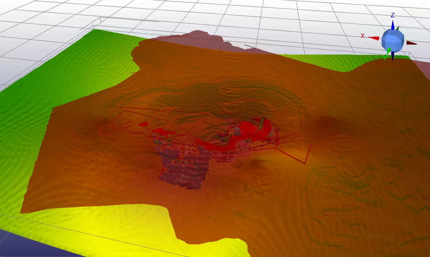
DIGITAL MINE™ incorporates an extensive set of tools developed for intelligent geological modeling, mine design, planning and surveying (including LiDAR laser scanning technology) and general mining operational support. Our software provides secure, rapid access to a variety of datasets (spatial, operational, engineering, financial) and high-resolution data models for mining engineers, geologists, surveyors, mechanical and electrical engineers, geotechnical engineers, geophysicists, operational personnel, and managers. Our information workflow enables customers to use their spatial datasets more effectively (geological, geophysical, seismic, hydro-geological, GIS, etc.): engineering and surveying data (mining plans, mining equipment parameters, hoisting operational data, monitoring and dispatch data, etc.), geochemical data (ore samples and assay analysis) and financial elements. This ensures informed decisions, operational efficiency, risk mitigation, clear reporting, simplified document flow and ultimately, improved safety and increased profitable mining operations.
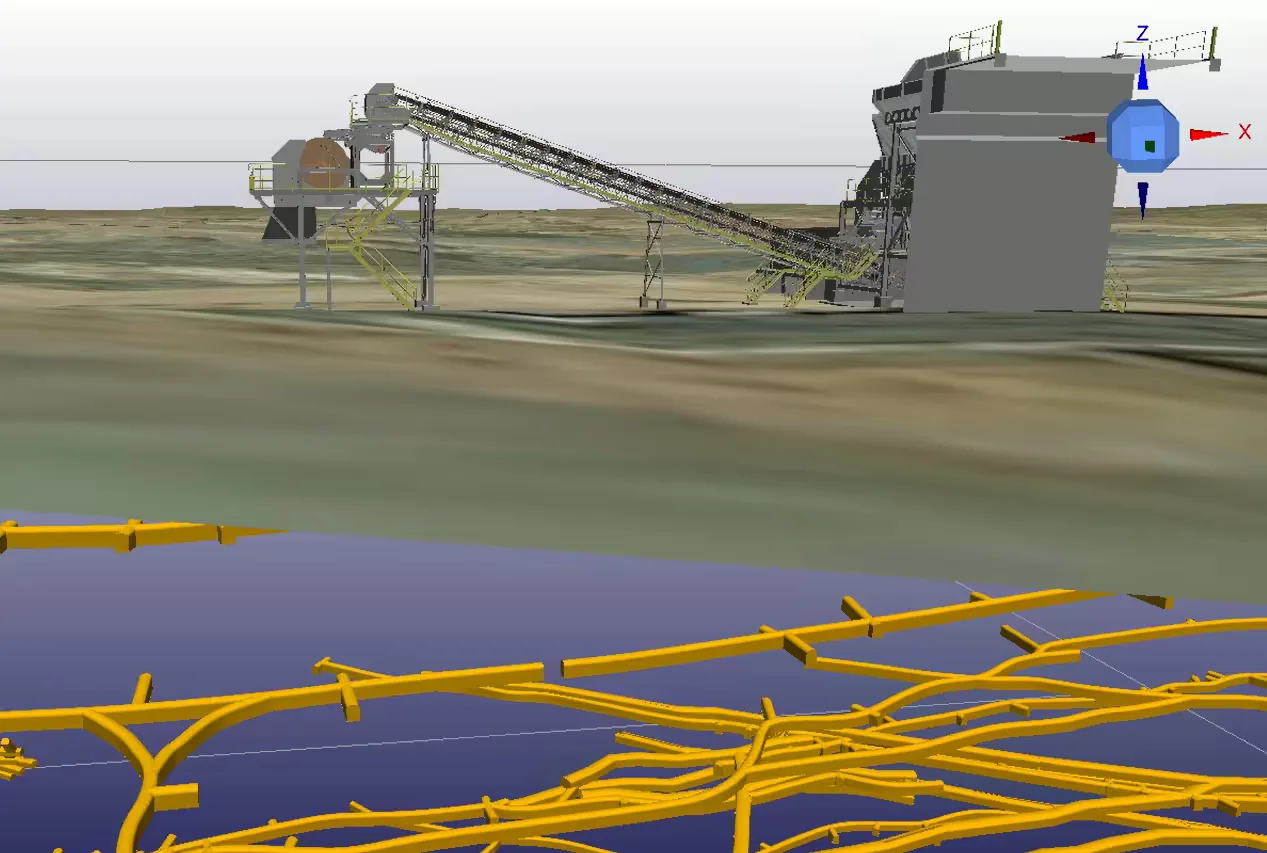
In addition to continuous informational support of mining operations, it is critically important to monitor, in real time, mining conditions as well as the operational status of essential mining equipment. This prevents hazardous situations such as subsidence, rock falls and rock bursts, sudden mud-rush or water inflows, gas emissions, etc. Mining companies currently use a variety of disparate monitoring systems rather than one integrated information support system.
DIGITAL MINE™ offers a holistic approach and integrates data streaming from any monitoring system into all mining operational processes and procedures.
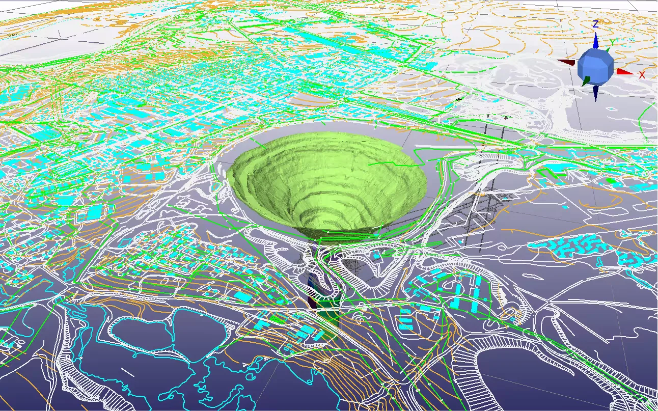
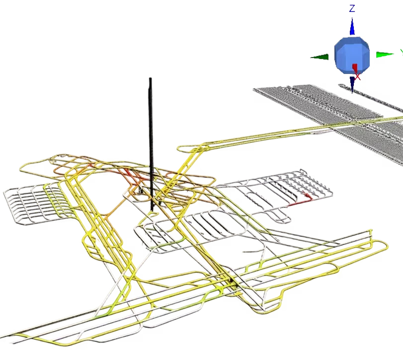
Real-time information support of mine operations in a continuously changing environment is essential and requires engineers to analyze enormous volumes of spatial data. The problem is exacerbated by additional operational data, which is constantly arriving and updating, from various monitoring sensors. Big Data management is particularly challenging in mining.
Sight Power and DIGITAL MINE™ technology provides a complete and effective solution for Big Spatial Mining Data management. Customers receive up-to-date 3D models of the mine, 2D thematic maps and other associated information, in real-time from anywhere in the world.
DIGITAL MINE™ provides mine owners, and their personnel, with instant informational control and monitoring, of their mining projects and operational activities.
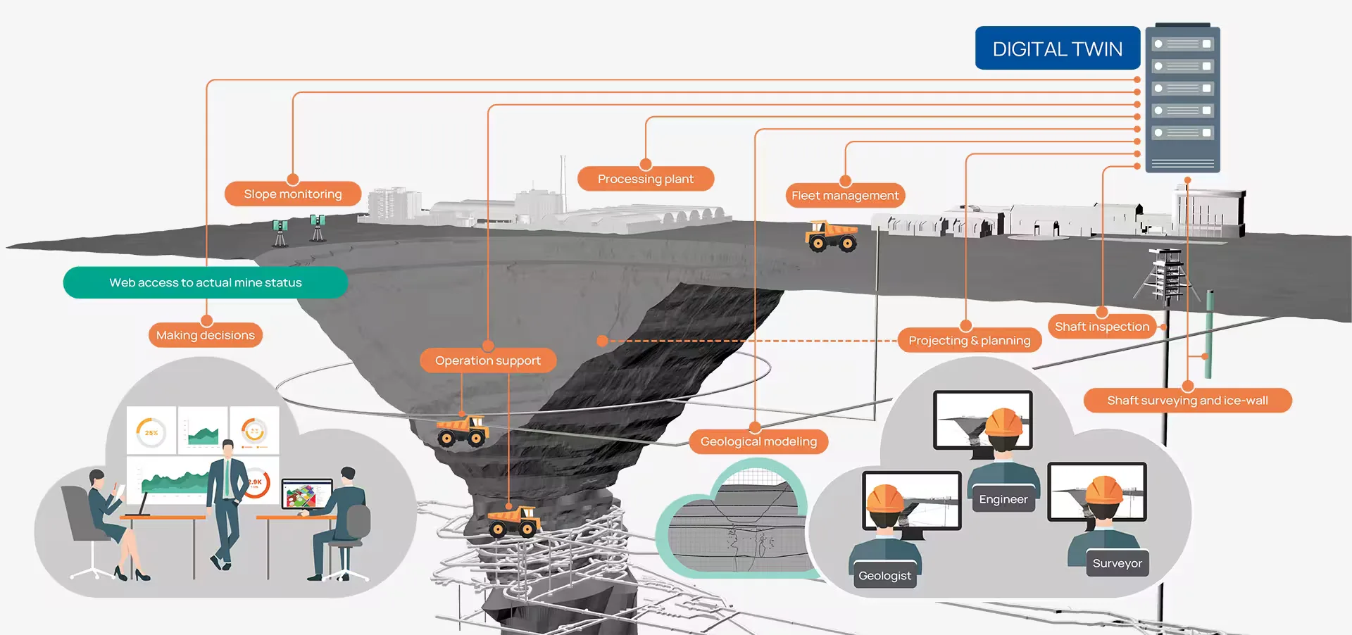
Introducing the SightPower Mining Data Platform — a powerful and flexible solution designed to transform how mining data is collected, processed, and utilized. Built with scalability and performance in mind, the platform enables organizations to efficiently manage complex datasets and gain actionable insights for better decision-making.
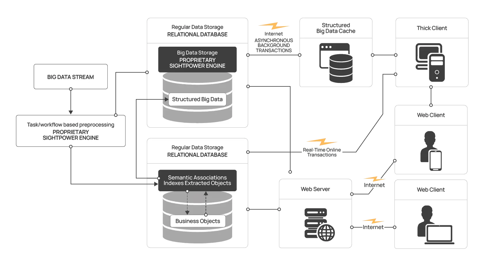
Spatial data streams are processed and divided into lightweight semantic data and heavy structured data. Semantic information and extracted objects are stored in indexed RDB tables for fast, real-time access. Heavy structured data is stored separately in a dedicated repository and can be uploaded asynchronously when needed.
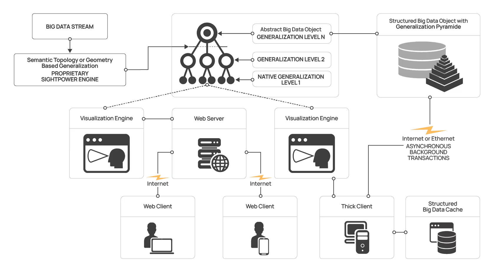
SightPower Big Data visualization generates a stack of generalization levels from spatial data, forming a Data Pyramid stored in fast-access storage. The visualization engine maps displayed images to the appropriate pyramid levels and supports both thick and thin clients. This approach allows large datasets to be structured in flexible ways, enabling efficient and versatile data analysis.
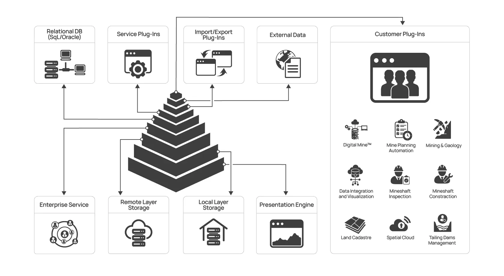
 Modular and extensible platform for big data spatial analysis
 Unique “data pyramid” allows rapid processing and visualization
 Open and expandable architecture
 Manages data integrity & data security
 Deployable in the cloud
 Customizable for a wide range of use cases