Sight Power Customization Department extends its scope of activities beyond development of intellectual software and sophisticated hardware-software systems.
Our engineers are able to accomplish specific custom orders that are aimed at resolving any arising problems. They can consult the customer within the field of automated spatial data processing regardless of volume, origination and type of data – including, but not limited to Geo-Information Systems, space and aerial photo analysis and resolution of corresponding optimization tasks.
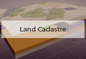
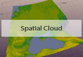
One of the most challenging and unique directions in Sight-Power services is the construction of spatial geological models of mineral deposits integrated with non-spatial data types. Our integrated models allow effective visualization of complex spatial geological structures and their components while facilitating the discovery of new structural patterns. This allows us to model and eventually optimize various engineering and economic scenarios.
We support any type of spatial data, such as:
- vector and raster data stored in GIS;
- geophysical (seismic areal and drill-hole), geological and any other data acquired by drilling, logging or seismic surveys;
- data acquired by aerial or satellite surveys;
- data acquired by above ground or aerial laser surveys (LiDAR);
- data acquired by radar.
Our consultants are also able to demonstrate how to return and multiply the investment placed into the spatial data collection.