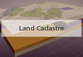
What is cadastre?
Wiki defines cadastre as a comprehensive register of the metes-and-bounds of real property of a country. A cadastre commonly includes details of ownership, tenure, precise location (including GPS coordinates), dimensions and area, cultivations if rural and the value of individual parcels of land. Cadastres are used by many nations around the world, some in conjunction with other records such as title registration. Useful information about national cadastres can be found at http://cadastraltemplate.org/.

Any land parcel must be associated with an assessed value within a cadastre. To do that, the cadastre should contain infrastructural and geological information. It can be treated as a comprehensive database of a country’s natural resources, utilities, and abundant land information. In addition, an extensive cadastre should consider land and mineral market prices. However, in practice, cadastres often provide only the parcel boundary and owner information. Geological and infrastructural aspects, changing market value of the land and buried minerals, as well as ecological aspects of potential developments, are not included.

In the past, cadastres were based upon paper records, maps, sketches, and diagrams. Since hardcopies of any sort are difficult to change and/or substitute, the cadastre systems were limited in scope and often did not match actuality. Today, the information-rich environment provides huge opportunities for increased effectiveness of usage, real-time updates, and uninterrupted online access and control. To implement best practices and obtain the best value, it is important to introduce innovative workflows.
The new look Cadastre structure and organization
Sight Power provides an advanced and effective integrated Cadastre system.
The following form the basis of Sight Power’s Cadastre system architecture:
- Integrated land information, detailed ownership data, infrastructural information, and geology.
- Security and rights of access are reliable and easily managed.
- Our Cadastre automatically reflects the land and mineral market with the ability to re-assess estimated market value of parcels on the fly.
- Provides precise parcel value assessment.
- Comprehensive and intuitive web-access for basic and special means control for management and technical staff.
- Visualization of 2D and 3D maps, charts, diagrams and plots.
- Auxiliary tools for customers (total value of numerous parcels, value of parcel section, etc.), as well operational tools for complete administration (ownership database updates, joining or dividing the parcels, etc.).
Cadastre best practices: reliability, security, support, simplicity
Scope of Services provided by Sight Power
Sight Power offers development of contemporary cadastre systems, including data conversion to new formats and unification of existing data (transferring data from the old system to the new and providing all necessary complementary data).
The service includes:
- Analysis of the current state of the system including land claim capture and methods of control.
- Collection of all current data related to land claims (data can be provided in hard or soft copy) and its integration into the new system.
- Investigation and clear depiction of all current claim disputes as well as the compilation of an expandable database containing all relevant information concerning land claims in question.
- Rapid and comprehensive data capture and registration of land claims as well as clash detection.
- Web access-based interface
- Viewing and editing modes depending on user rights.
- Worldwide accessibility with linkage to the main database containing all current and newly registered land claims.
- Specific data is displayed when a land claim is selected.
- Connection and visualization of geological content for all parcels.
- Mining Development support if requested.
- Custom tools and analysis if requested.
Typical workflow for the creation of custom cadastre system
- Client requirements and specification
- Involves discussion and client specification analysis.
- A detailed business plan and method of approach.
- All specifications are included.
- All capabilities are explained and clarified for every requirement.
- Collection and analysis of the required data
- The collection of all available data occurs.
- Close working relationship is established between Sight Power and all data collection entities.
- All data relating to the registered land claims, not limited to geological data, topographical, aero magnetic scans, aerial photographs, photo telemetry, etc., as well as any other documentation, is collected and analyzed for integration into the new system.
- Info integration
- After analysis, the data is fully logged and integrated into the new system.
- Meticulous testing of data consistency is performed.
- Connections between database tables are set up; the complete cadastre database is created.
- Client tests the system for interface convenience, scalability, level of security.

3D underground cadastres are an essential business tool
Data collection methods provide the components for creating a comprehensive description of the environment. The combination of static and mobile LiDAR, RADAR, aerial photos, 3D seismic and gravimetric surveys allow Sight Power to compile highly accurate land value and usage models. Structured and organized, these models drastically improve efficiency, level of control and the commercial value of natural resources, while reducing adverse environmental impacts.
Land resource users are increasingly recognizing the necessity of changing their approach to the organization and content of cadastre systems, as well as the requirement to utilize 3D models and point cloud data. At the 3rd International Workshop in China on 3D Cadastres, a speaker* said that “…the 2D plans cannot indicate real world events, the 3D situation can represent real world and a more accurate location when it comes to underground utility and resources…”
*3D Modeling for Multipurpose Cadastre by Alias ABDUL RAHMAN (Malaysia), Peter VAN OOSTEROM, (The Netherlands), Teng CHEE HUA, Khairul Hafiz SHARKAWI, Edward Eric DUNCAN, Norsuhaibah AZRI and Muhammad Imzan HASSAN (Malaysia), at 3rd International Workshop on 3D Cadastres: Developments and Practices 25-26 October 2012, Shenzhen, China